Satellite monitoring of transport
Satellite monitoring of vehicles using signals from GLONASS / GPS navigation systems is carried out in the Optimum SmartGIS geographic information system.
Key features
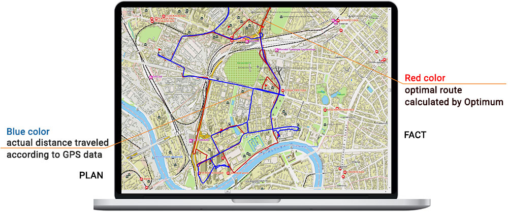
- Satellite monitoring of the movement and location of transport (visualization of the Plan-Fact routes).
- Monitoring the readings of any sensors installed in the car (for example, opening the doors, changing the temperature in the refrigerator, fuel level, etc.).
- Monitoring the readings of the sensors of the driver's mobile device (GPS / GLONASS, accelerometer, gyroscope).
- Control of emergency situations, deviations from the route.
- Automatic receipt of notifications about emergency situations (alarms).
- Checking the passage of control points of the route in time.
Related software
Optimum SmartGIS
Zlenko T.V., National Direct Distribution Manager, SUN InBev JSC


Contact us
Related articles All articles
 News
News
18 november 2021
CDC presented a new version of the cloud service for monitoring the delivery of perishable goods
 News
News
27 september 2018
The Optimum GIS reduces the costs of transportation of AB InBev brewing products
 News
News
29 may 2018
PepsiCo equips freight transport with a temperature monitoring system
 News
News
01 march 2016
SUN InBev Implements the Optimum TMS to Automate Transport Logistics
 News
News
16 january 2016
CDC Automates Collection and Delivery of Mail at ‘Spetssvyaz’ Rossii’