Optimum SmartGIS
The geographic information system Optimum SmartGIS consists of a server part, which provides automatic route planning for the delivery of goods and satellite monitoring, as well as a mobile application for the driver (forwarder).
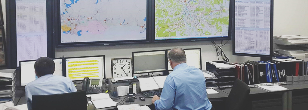
Situational center based on Optimum SmartGIS solutions
The system is capable of calculating routes for a fleet of several hundred vehicles in a matter of minutes, taking into account the road situation, type of vehicle, carrying capacity, body volume, cost of the flight, delivery windows (40+ calculation parameters), monitor the location and condition of the cargo, warn the dispatcher about emergency situations on the route. Also, on the basis of the system, solutions have been developed for route planning and monitoring of mobile personnel.
The Optimum system is included in the Unified Register of Russian Programs for Electronic Computers and Databases of the Ministry of Digital Development, Communications and Mass Media of the Russian Federation.
Efficiency
- Reducing transportation costs by an average of 25-30%
- Reduction of route planning time by at least 3-10 times
- Increase in average utilization by 10-15%
- Shortening routes
- Reducing fuel consumption by 20-30%

OPTIMUM GIS has not only established itself as the best-in-class solution, but also proved its effectiveness in practice!
Tasks
- Automatic and manual calculation of the optimal routes for transport and mobile personnel.
- Satellite control of the location and movement of vehicles and mobile personnel.
- Sensor monitoring (temperature, fuel level, CAN bus, etc.).
- Providing the driver (freight forwarder) with the necessary information about the route, cargo, etc.


Key benefits
Contact us
Projects


Related articles All articles
 News
News
CDC presented a new version of the cloud service for monitoring the delivery of perishable goods
 News
News
The Optimum GIS reduces the costs of transportation of AB InBev brewing products
 News
News
PepsiCo equips freight transport with a temperature monitoring system
 News
News
CDC presents SFA solutions at L’Oreal conference
 News
News
IT solutions on the basis of the Optimum platform included in the Unified Registry of Russian Software Products